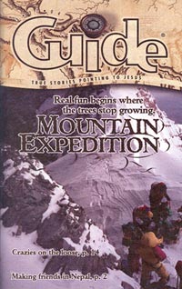
Today mountain climbing is a popular sport. People scale the summits for the challenge, the thrill, and the spectacular views.
But back in the 1600s mountains did not have this appeal. They were places of danger, many believed, where a cough could trigger an avalanche or where gods and angry monsters lived. Mountains were seen as “boils” or “warts” on the earth’s complexion. Travelers went around mountains or between them if necessary, but not up them.
In the past 350 years humans’ attitudes have changed. Today approximately 10 million Americans go mountaineering every year, and 50 million go hiking. Today mountain climbing is a popular sport. People scale the summits for the challenge, the thrill, and the spectacular views.
GETTING USED TO IT
People who have lived in the mountains for generations have adapted to their thin air. Their blood has more red cells that can pull more oxygen from thin air. For them thin air feels normal and causes no inconvenience.
For people who live at sea level it takes about two weeks to adjust, or acclimate, to less oxygen. Eventually it becomes normal for them, too.
MAKING MOUNTAINS
“Folded” mountains occur when layers of rock are bent into folds by colliding continental plates.
You can re-create the formation of folded mountains with two pieces of soft clay the size of your fist, two pieces of aluminum foil about five inches long, and a thick dowel rod or a piece of broomstick.
First, form each piece of clay into the shape of a brick. Place each brick on a piece of aluminum foil. Each piece of clay represents a land mass, and the foil is the continental plate it rides on. In real life it usually takes many years for plates to collide and make mountains (unless there happens to be a big Flood involved), but you can create mountains in seconds.
Hold one clay brick with each hand, or have a friend hold one, and slide them together as fast as you can. What kinds of shapes are formed?
Separate the clay, and reform it into bricks. Roll the dowel under the end of one brick. Now try slamming the other brick into the propped-up end. What happens now? Try different shapes and sizes of clay, and see what other landforms you can make with collisions.
MAPPING THE MOUNTAINS
In the early 1800s the British government of India began the largest surveying project in history, called the Great Trigonometrical Survey of India. The idea was to map India from its southern shores to the northern mountains. This included the Himalayas and a tall mountain known to surveyors as Peak XV.
In those days there were no satellites or Global Positioning System (GPS). Measuring the heights of mountains involved sighting the top of a mountain through a telescope and recording a series of numbers that gave the exact angle between the horizon and the summit. Surveyors created a grid of linked triangles crisscrossing the country from hilltop to hilltop. Where there were no hills, engineers built towers every 10 miles to see above the jungle and view the curvature of the earth.
Surveying equipment and building materials were hauled through the swamps and forests with ox-drawn carts. Elephants carried the heavy equipment, including the 1,200-pound surveyor’s instrument called the Great Theodolite.
Once the surveying was complete, teams of mathematicians calculated the figures by hand and discovered that Peak XV was 29,002 feet high, the tallest mountain in the world. (Their measurements missed today’s calculations by only 33 feet.) Peak XV was eventually named Mount Everest after Sir George Everest, chief surveyor for the project.
Written by Jane Chase
Illustrated by Photodisc